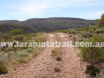
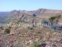
| Section 9 is a long walk if you plan to do the
whole section in one hit, with a number of rocky and loose ascents and
descents, particularly from Waterfall Gorge to the Mt Giles Lookout. It is
however, one of the most impressive and scenic sections along the trail.
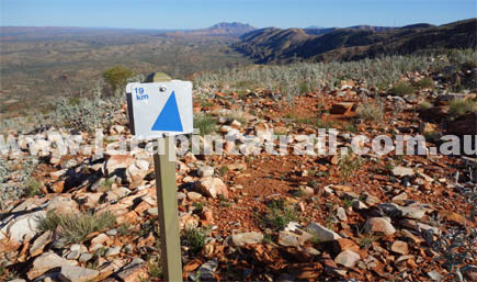
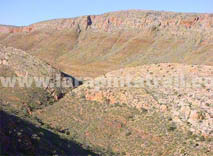
From Mt Giles Lookout onwards there are excellent 360 degree views,
particularly impressive views of Mount Giles to the north and Mount Sonder to the west. |
| |
 Snapshot Snapshot |
|
 |
One of the longest sections on the trail |
|
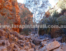
Waterfall Gorge makes a good half way campspot |
|
Steep ascent to Lookout from Waterfall Gorge |
|
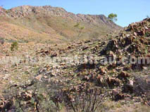
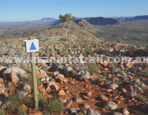
High ground is rocky going, but has excellent views |
|
| Highlights |
|
|
Spectacular 360 views from Mt Giles Lookout |
|
Nice campsite at Waterfall Gorge |
|
Inarlanga Pass and the cycads |
|
Great expansive views of Heavitree Range |
|
 Related Links Related Links |
|
|
|
 |
|
| |
| Trail Grade |
 |
Hard:Suitable for experienced walker |
| Distance (km) |
28.6 |
|
| Duration (hrs) |
12 |
Comfortable. Allow sightseeing |
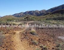
| Terrain |
Rough |
Rocky, loose |
| Gradient |
Hilly |
Steep going |
| Trail |
Average |
Trail is reasonably well defined |
| Water |
Yes |
Limited. In tanks only. |
| Shade |
Limited |
Very open country. Little shade |
| Camping Fees |
Yes |
Ormiston Gorge ($10.00 per person) |
| Campsites |
Yes |
S9 Campsites page  |
| Walk Options |
Yes |
Overnight - Multiday - Extended |
|
|
|
|
|
|
|
|
|
|
|
|
|
|
|
 |
S9 Webpage  Coming Soon Coming Soon |
|
NT Parks Section Fact Sheet and Trail Map  |
|
NT Parks Section Fact Sheet and Trail Map |
|
|
|
|
 Getting to Serpentine Chalet Dam Trailhead Getting to Serpentine Chalet Dam Trailhead |
 |
The Serpentine Chalet Dam Trailhead is approx 105km west of Alice Springs and can be accessed via the sealed Larapinta & Namatjira Drives. From Namatjira Road to the car park is a 3km 4WD only dirt track. Vehicles cannot access the trailhead directly. There is a locked gate. It is 750m from the car park to the trailhead.. |
") Getting to Ormiston Gorge Trailhead Getting to Ormiston Gorge Trailhead |
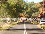 |
The Ormiston Gorge Trailhead is located 135 km west of Alice Springs. Access is via the sealed Larapinta and Namatjira Drives. Easy sealed access by 2WD all the way to the main Ormiston Gorge car park. |
 Blog: Accessing Trailheads Blog: Accessing Trailheads |
|
|
|
 Connected Walks & Trails Connected Walks & Trails |
| Serp. Chalet Dam |
|
| Ormiston Pound Walk |
|
| Ghost Gum Walk |
|
|
 Off Track Off Track |
| Bowman Gap |
|
| Mount Giles |
|
|


