Walking Options Homepage // Day Walks / Overnight Walks / Multiday Walks / Extended Walks / End to End Larapinta Trail Facebook Page.
 
 
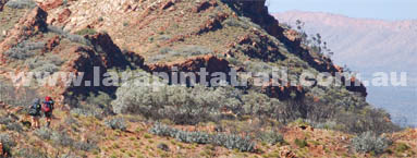
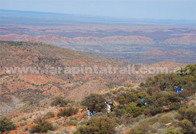
One of the best trek options of the Larapinta Trail is the End to End (E2E) full traverse of all 12 sections. Walkers get to experience the full variety of landscapes, challenges and rewards of the Larapinta Trail. It is a challenging and rewarding long distance trek which requires a high level of fitness, experience and preparation. It is one of Australia’s best long distance treks which can be completed comfortably over a 15-16 day period, but the duration will vary based on your level of fitness and time constraints.
Point 223km full traverse for all 12 sections
Point Walkers must be fully self-sufficient.
Point Suited to fit and experienced bushwalkers/trekkers
Point Requires detailed planning, particularly for food/water resupply.
Point Can be completed comfortably in 14-15 days
Point Ideal is 18-20 days
Point Great off track options such as Mt Zeil and Mt Giles.
Point Heading in East to West is the most popular and best way to go.
Point Take cash to pay for campsite fees
Point Trail is mostly easy to follow and well sign posted
Point There are showers at Ormiston Gorge, Glen Helen Resort & Standley Chasm
Point There are bins at: Simpsons Gap, Standley Chasm & Ormiston Gorge
Point Food storage points : See List Here
Point Tank water is available at all main trailheads and intermediate points
Point There are few permanent natual water sources along the trail.
Point Biggest cause of End to End incompletion is injury and equipment failure
Point Kiosk/shop at Ormiston Gorge, Glen Helen Resort, Standley Chasm & Telegraph Station
 
This is a guide only. How you plan to complete your End2End will be a very individual or group choice which will be influenced by you and/or your groups time constraints, resources, fitness, experience levels, and what decisions you make on the day. Note: Alternative day/night finish points detailed below may extend the time (days) more than is shown.
Abbrev: THD: Trailhead CMP: Campsite ALT: Alternative
If you sustain an injury or have an emergency and have the ability to initiate a rescue ( i.e. EPIRB or satphone) expect to wait between 12-24 hours for rescue. If you don’t have an EPIRB or satphone and rely on a runner, expect the wait to be between 24-48 hours. Always remember, if you need to yell for help it is extremely difficult to be heard out in the open along the Larapinta Trail because of the wind and terrain –always carry a whistle.
 
Your itinerary will largely be influenced by your water needs. Each trailhead and intermediate point has water tanks which can be used for resupply. There are very few reliable natural water sources along the Larapinta Trail. (Read blog).
 
Camping on high ground overnight will require rationing your water. Water will also be a main consideration for any off track walks since there are no tanks anywhere off the Larapinta Trail or away from the main visitation areas. Natural water sources are extremely limited in this area.
Boil or treat the tank water if you want to be 100% sure that its bug free. Some hikers don’t and have no problems, but it’s still a risk each hiker weighs up individually
Food Storage If you cache your food along the trail instead of using the food storage rooms, pack them well to protect against human tampering ( i.e. hide them well) and protect them against wildlife pillaging, mainly dingoes
 
The best time to walk the trail ( i.e. coolest weather) is between May and August. The busiest time on the trail is June and July.
 
There is about a 20-30% chance of rain over a 15-16 day period on the Larapinta Trail. Sometimes it can drizzle for a week at a time, anytime of the year, including May-August.
 
Downpours and the resulting flash floods and general flooding, while not frequent, does occur. Keep this in mind if you plan to camp or trek in narrow gorges, crevasses, creeks and rivers during heavy rain.
Boulders and massive trees weighing hundreds of kilograms are thrown around creeks and rivers during these floods.
Comfort Zone: If you carry an air mattress ( a good idea along this terrain) protect it against the spinifex. This grass is needle sharp and will quickly turn your mattress into a pin cushion. Carry enough patch kit too.
 
Boot soles are one of the biggest equipment/clothing failures along the Larapinta Trail. Have a repair kit for this eventuality too
 
Generic 17 Day End to End Itinerary
Day One Start: Telegraph Station THD Section 1
Finish: Simpsons Gap THD
Alt Finish: Wallaby Gap CMP
Alt Finish: Hat Hill Saddle
Day Two Start::Simpsons Gap THD Section 2
Finish: Mulga Camp CMP
Alt Finish: Jay Creek THD
Day Three Start: Jay Creek THD Section 3
Complete via Alt High Route
Finish: Standley Chasm THD
Alt Finish: Millers Flat CMP
Day Four Start: Standley Chasm THD Section 4
Finish: Brinkley Bluff CMP
Alt Finish: Stuart's Pass CMP
Day Five Start: Brinkley Bluff CMP
Finish: Birthday Waterhole THD
Day Six Start: Birthday Waterhole THD Section 5
Finish: Fringe Lily Creek CMP
Alt Finish: Hugh Gorge Junction CMP
Day Seven Start: Fringe Lily Creek CMP
Finish: Hugh Gorge THD
Alt Finish: Hugh Gorge Junction CMP
Day Eight Start: Hugh Gorge THD Section 6
Finish: Rocky Gully CMP
Alt Finish: Ghost Gum Flat
Day Nine Start: Rocky Gully CMP
Finish: Ellery Creek THD
Day Ten Start: Ellery Creek THD Section 7
Finish: Serpentine Gorge THD
Day Eleven Start: Serpentine Gorge THD Section 8
Finish: Serpentine Chalet Dam THD
Alt Finish: Counts Point CMP
Day Twelve Start: Serpentine Chalet Dam THD Section 9
Finish: MT Giles Lookout CMP
Alt Finish: Waterfall Gorge CMP
Day Thirteen Start: MT Giles Lookout CMP
Finish: Ormiston Gorge THD
Day Fourteen Start: Ormiston Gorge THD Section 10 & 11
Finish: Hill Top Lookout CMP
Alt Finish: Finke River THD
Day Fifteen Start: Hill Top Lookout CMP Section 11
Finish: Rocky Bar Gap CMP
Day Sixteen Start: Rocky Bar Gap CMP
Finish: Redbank Gorge THD
Day Seventeen Start: Redbank Gorge CMP - Mt Sonder Section 12
Finish: Redbank Gorge THD
 
 
Larapinta Trail Website
Disclaimer | Copyright | Privacy | Terms of Use | Webpage Updated June 2015
© World Expeditions 2024